
|
After six days of storm chasing I barely had time to settle myself when yet another storm day presented itself barely five days after the last big event when I had intercepted three simultaneous storms in Co. Tyrone rumbling away all around me into the late afternoon. The remarkable month that is June 2023 continues to produce with yet more sunny warm and humid weather and further thunderstorm potential. As I mentioned in my previous chase report I had experienced so much action during this period that my chasing confidence had gone through the roof and I felt like I couldn't fail, I was on a roll and loving every precious moment of it.
Sunday June 25th began very sunny and within a few hours the late morning was already humid, the air had that 'wet' heavy feel to it which just screamed thunderstorms. Our instability values were down somewhat, or at least in comparison to the 1000j/kg to 3000j/kg of CAPE we had been experiencing during that exceptional week long outbreak. Today we would be dealing with +800j/kg of CAPE which in all fairness is what we would consider great values for a 'normal' mid Summer thunderstorm day, so putting this into perspective we were still dealing with very good instability which when combined with other favourable parameters had the potential to produce big storm updraughts. To be honest I was just going with the flow and like a blood hound onto a scent I was just going to trust my instincts and chase. After the incredible explosive updraughts I witnessed on June 19th I wasn't expecting to see decent structure even remotely like that again, however little did I know that surprisingly cool scenes would unfold on the hours ahead.
With cloud top temperatures colder than -40C and surface temperatures peeking at 25 to 27 degrees C there was great potential for tall storms, furthermore with speed shear in the 20 knots range multicell thunderstorms looked to be on the cards. With a fairly gentle Wly surface flow meeting a NEly on-shore sea breeze one or more convergence zones were expected to form and it was along these where I intended to make my play. The best overlap of CAPE with maximum surface heating and model precip looked to be in the NE, E and SE of N. Ireland so Counties Antrim, Down, Armagh and the Lough Neagh basin all looked like good target areas. The AROME was showing cells in all these areas with the strongest cores in the NE and SE, the cloud top temperatures were colder over the E of the province and even more show over the SE. The Met Office had issued a yellow warning for thunderstorms in all these areas and Owain Rice, our facebook forecaster, had issued an amber box for the same areas with a chance of funnel clouds and landspout tornadoes.
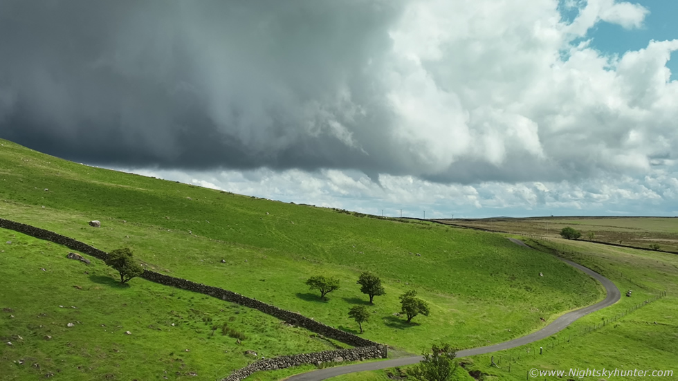
I had two target areas in mind, the Ballymena area or SE of the Lough in Co. Down, however since I wasn't as familiar with the road network in that area I instead decided on the Ballymena area. The reason was I was familiar with the terrain, it had good countryside around the main town and scenic fields and landscapes which would work well for storms, I just needed a good vantage point from which to observe the sky, that was the decider. My final decision was either Slemish Mountain or the countryside in Broughshane or even onto the scenic Glens Of Antrim in the hills, those would be my target areas. Initiation looked to occur in the afternoon however I was already up early, I never like being late to any of nature's parties so I always like to leave in good time and be early to watch and wait and enjoy the full experience. Roisin was on her holidays so she and Rhua would be joining me for the day, we decided we would commit the entire day to the chase and make an adventure out of it. We would be driving in Roisin's Kia so I shifted across all my camera gear and tripods, got drinks and snacks then we hit the road at 11.00.
The sky was blue and clear, the sun was shinning and it was already mildly unconformable with isolated convection bubbling up randomly in all directions. Despite some complaints about the humidity this was nothing like the major humidity we had experienced for several days at Mullaghmore in Co. Sligo which was off the charts. This set-up was different, we had a front during the night which cleared the air out so even though it was humid it didn't feel as heavy as other chases, this was actually a good thing for storm photography, it meant good visibility and clear air around cells and hence a greater chance of photo opportunities.
We arrived on the outskirts of Ballymena and thanks to one of Roisin's Sisters we were pointed in the direction of a nice restaurant, sorry I can't recall the name of the place or I would promote it here. In any event we got a nice take away dinner, then found a lovely walled garden area then sat on a picnic table and enjoyed a warm meal in the hot sunshine beside a refreshing pond and water fountain. It was nice to build up the energy for what was shaping up to be a busy day. Roisin and I did notice that the convection we could see wasn't particularly great, it seemed stunted and lifeless which wasn't a good sign, however things can and do change later, I suspected a cap was in place but during the hours ahead with stronger solar heating and lift from a trough and that convergence zone, wherever it would be, would likely tip the scales and we could get rapid storm development, we just had to be patient and let nature do her thing.
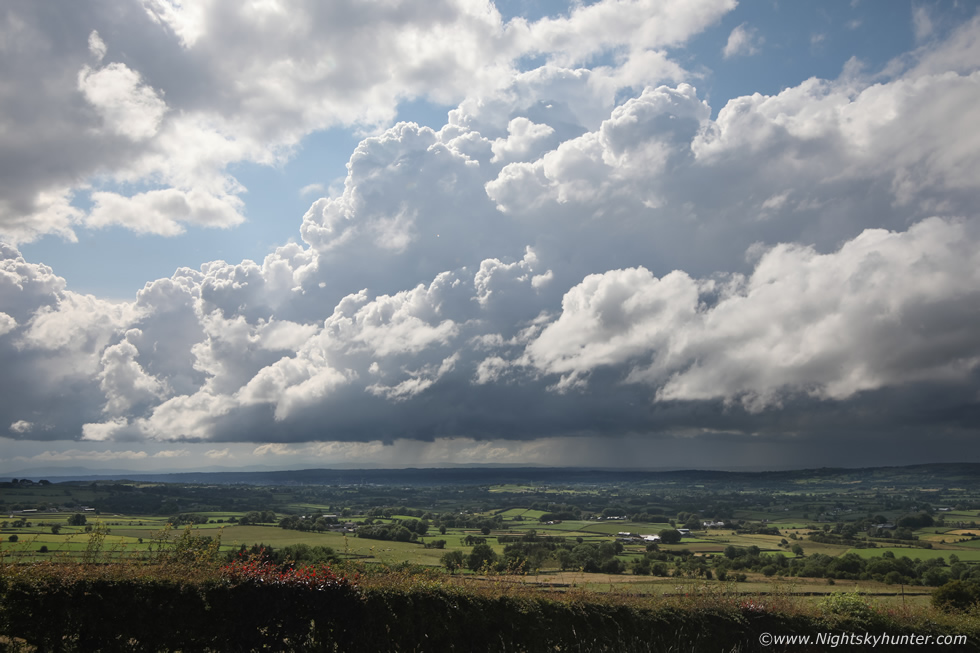
Roisin, Rhua and I made our way through Ballymena then for some reason I just felt drawn to Broughshane and naturally I was drawn to the famous and majestic Slemish Mountain. What better way to watch storms than from an ancient volcanic plug, when we pulled into the car park we saw chaser Colleen Webb already in position, she had the same idea as us. Being at this location brought to mind our Winter chase back in March this year when we had an amazing day filming snow with the drones so it felt good to be back once again. Rhua got out to run around while I got the camera gear ready, I spent some time scouting out a few fields with nice foreground bushes which might come in handy later. It wasn't long before all of us were pointing at clouds and anticipating storms and funnels, the sky was already talking, big time.
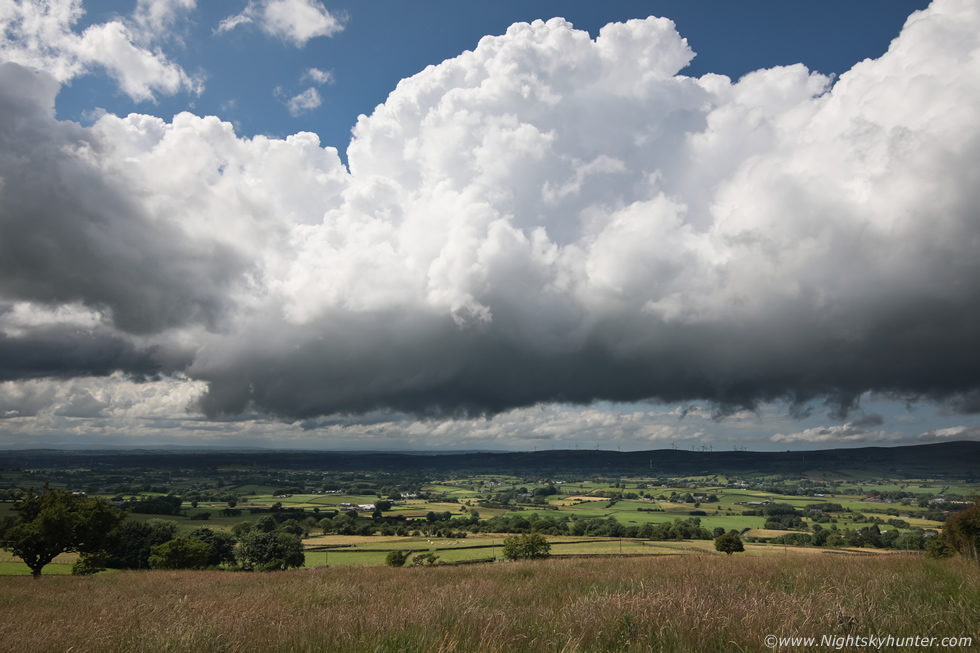
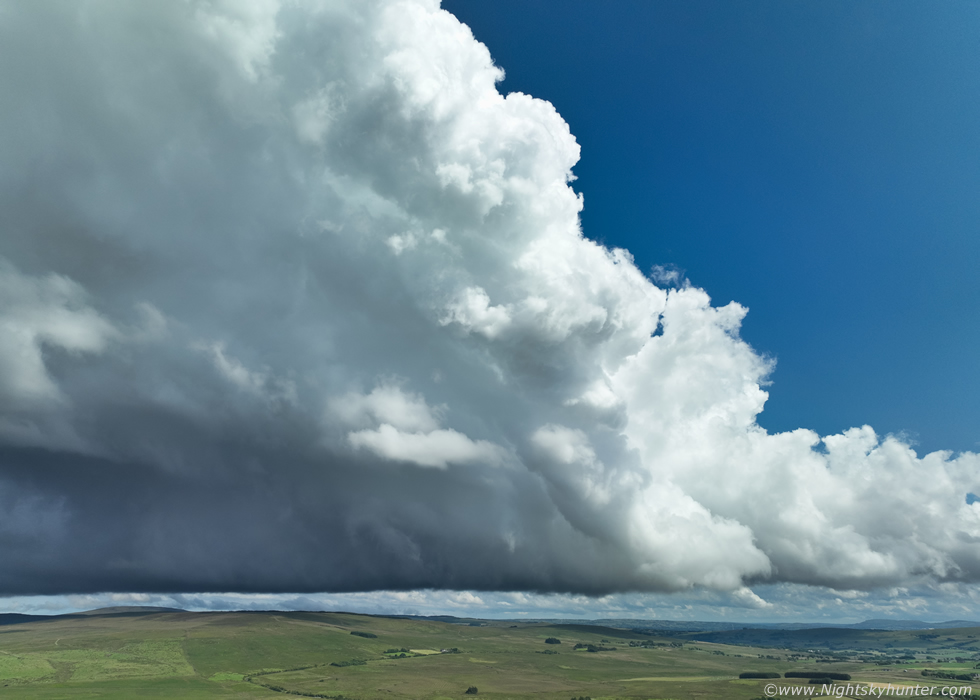
We were admiring a nice line of sunlit convection bubbling up strongly under the cap, it was struggling aloft however we could sense the pressure building in the atmosphere. Despite their restricted depth the convection was strong and crisp and looked photogenic, it was slowly moving from L to R and closer to us, then we began to notice strange behavior under the base with opposing motion taking place, it took a moment to work out but then it clicked, we where rite on or close to a convergence zone, the very place I wanted to be, this was good news and a stroke of fabulous luck. Convection was moving L to R yet low level cloud was feeding in swiftly from R to L rite into the line of bases, it was like witnessing a dramatic collision of air masses, we knew this could be the focus point for funnel clouds so our levels of excitement and anticipation began to ramp up.
 |
The area of interest was getting bigger and more agitated so I set-up the DSLR in a nice field and began shooting a time lapse. This is looking W from the flank of Slemish, convection moving L to R but also inching closer to us. There was a lot of motion going on under that base due to the convergence zone, I was getting fairly confident this was going to deliver. Then Nigel McFarland arrived who had just finished up some drone filming at the north coast and was eager to get out chasing for the day so the three of us prepped our gear and really zoned into the sky.
 |
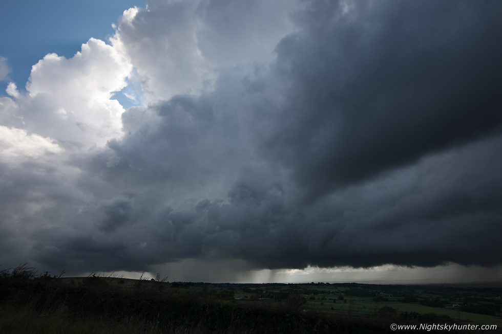
The line of convection was getting closer however we we concerned by low dark grey cloud that was blowing in from behind us from the NE meeting this cell, initially we read the situation wrong, the increased breeze and cloud cover was going to kill our solar heating, we figured this horrible cool low level cloud was going to hang around for a while and that we might have to move to another location, but we had momentarily miss-read the sky. We where directly under the convergence zone, that elemental meeting place where all the magic can happen was rite over us which then began feeding into the convection beside us, this was the area of interest were striking opposing cloud motions were intersecting.
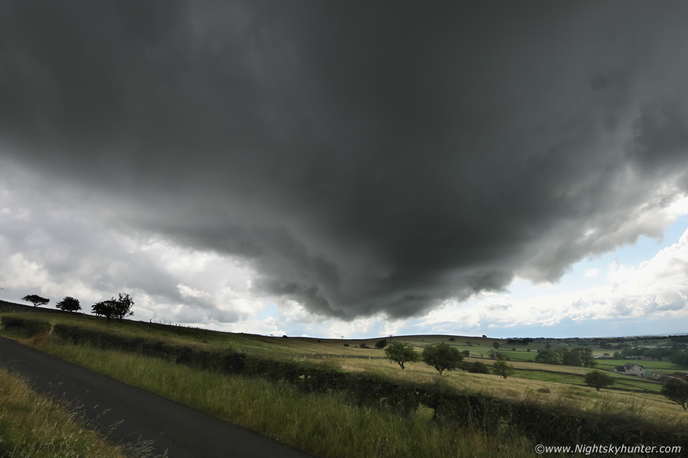 |
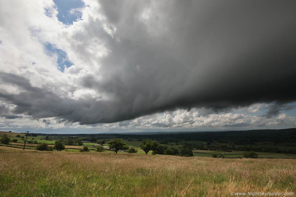
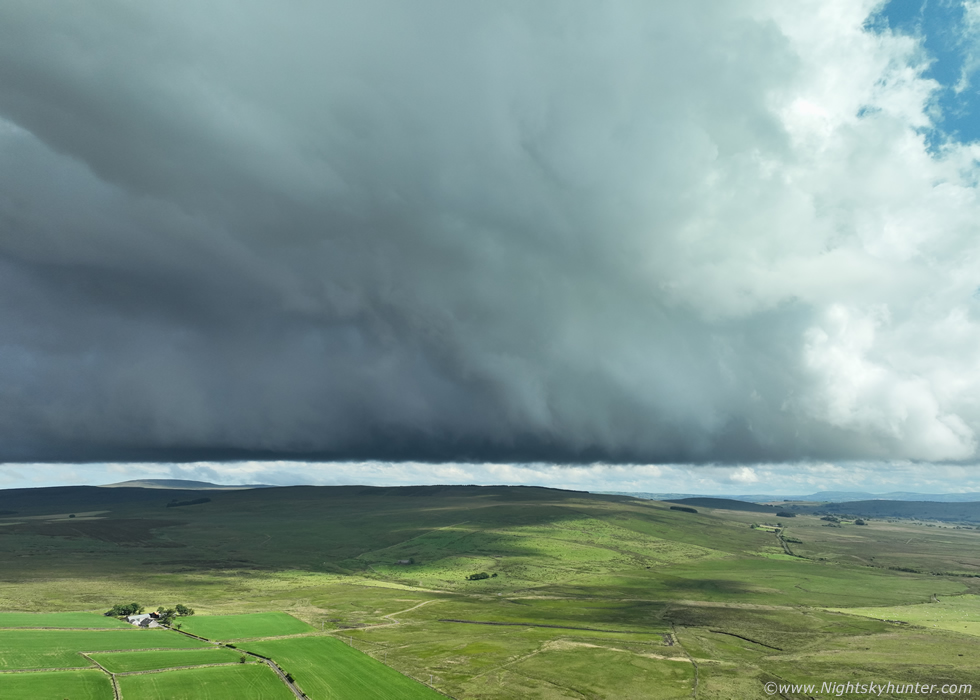
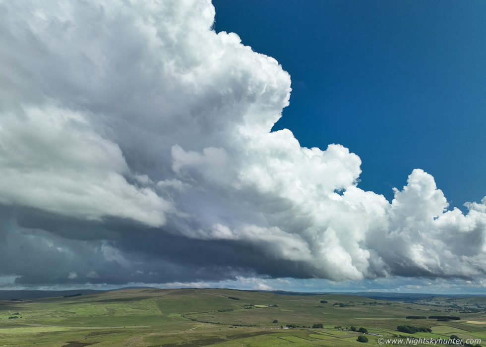
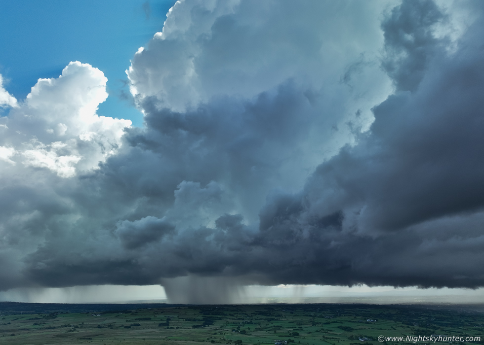
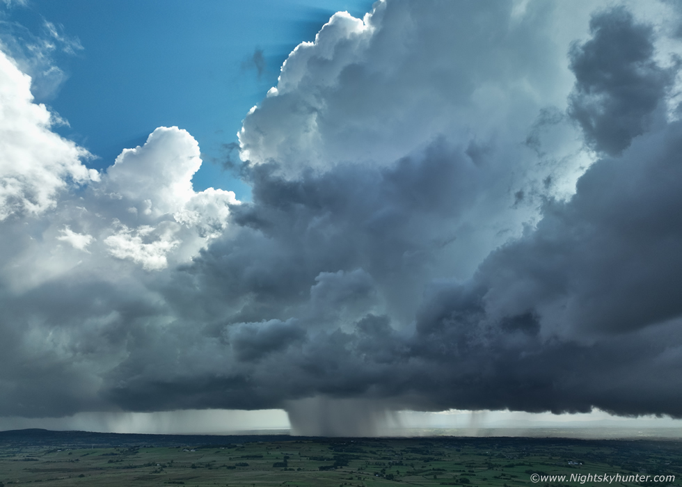
The sky turned overcast and the breeze passed through and it began to heat up again, when we saw this scene we lost any doubts we had about what was going on. What to us seemed like grey overcast skies was actually the growing base of a developing storm, we where literally directly below the base when it was rapidly forming, we where literally under a storm updraught. This was the view minutes later, a large updraught base with a lowering featuring strong storm relative inflow, and that big lowering was rotating! Colleen and Nigel got their drones in the air and called out reports that the area looked impressive from the air, I decided I wanted a time lapse of this base so I grabbed the camera and headed off across the fields below the mountain.
 |
I was stopped by a tall stone wall so I set up the DSLR and tripod on that, two legs on the stone wall and the third leg balanced on a fence post, the tripod held so I went with it. 15mm super wide angle on full frame, time lapse began, stopped down to F/11. That entire huge lowering was rotating, there was interesting rising and churning scud motion below it, I was hoping this would produce a funnel or even a tornado at any moment, if I got that on a time lapse it would be a true feather in the cap. I ended up getting a short but good time lapse of this scene showing the base curling with cloud ingesting inflow into the base as the entire area continued to organize, then the lowering of scud disappeared over the brow of that hill and I lost it from view.
I made my way back to the car park, Nigel had just landed his drone after shooting a pano of the entire base, Colleen was still flying and I was contemplating whether or not to put my own drone up, I spent perhaps five minutes pondering this which wasn't a good decision, when you feel your instincts telling you to do something just do it and don't question them. Moments later Colleen shouted 'funnel!'', she called us over for a look, and there on her control screen was the live view of a classic funnel cloud, it was a nice one too, dark in colour with a well defined shape directly under that rotating base, the convergence zone had delivered!
 |
I knew that many funnels don't last long, typically seconds to minutes but I tried to get some record of it, I got the Mavic 3 Classic in the air and began recording video as I flew the drone over the now sunlit fields. I managed to get it, just about, the funnel was already past its most photogenic stage and was already weakening, this is a still frame from the footage.
 |
I was kicking myself that I didn't get the drone up earlier but at least I got part of it on camera. This the second funnel cloud we have seen as a chase group this season so far and the first either of us have captured with a drone, you can watch this sequence in the vlog below. Congratulations to Colleen for catching this funnel at its best, she was saying all day about how she really wanted to capture a funnel, this was a great result, the day had been a success already. We saw another image of this same funnel posted on social media soon after taken from the far side, from there the funnel was white and in sunshine and it looked very dramatic. I landed the drone then we spent a few minutes celebrating the funnel and admiring Colleen's images when suddenly a big crack of thunder erupted from the sky behind Slemish from the direction of that very same cell, now we had a thunderstorm!
 |
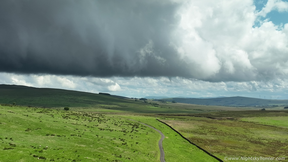
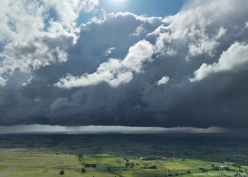
I got the drone in the air, this time much faster with no hesitation and settled the aircraft at 120m altitude. This is the wide angle view of that same base which had just moved E of our position, it was still swirling and had that strong convergence zone motion along the base. Actually what a text book perfect rain free base this was, this is the region you want to be watching for funnels and tornadoes.
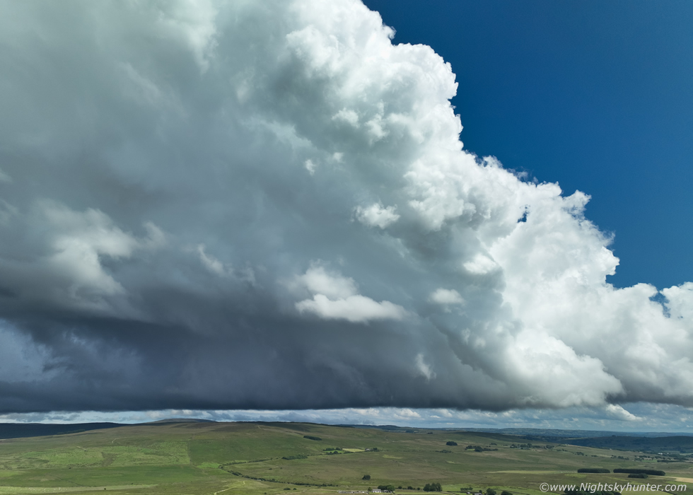 |
Moments later the cell was simply spectacular, the sun had lit up the flanking region and a massive solid updraught plume went up in full sunshine against clear blue sky.
 |
I said to Nigel ''this is what I wanted to see'', storm structure, the updraught tower was simply beautiful, I couldn't even tilt the drone's camera high enough to take in the full vertical extent of the tower. To me this is what storm chasing in N. Ireland is all about, capturing these stunning updraughts in the hot afternoon sunshine with thunder rumbling over our beautiful countryside while watching in awe in a t-shirt, to me this is what it's all about, I wait all year every year in the hope of experiencing these wonderful moments.
 |
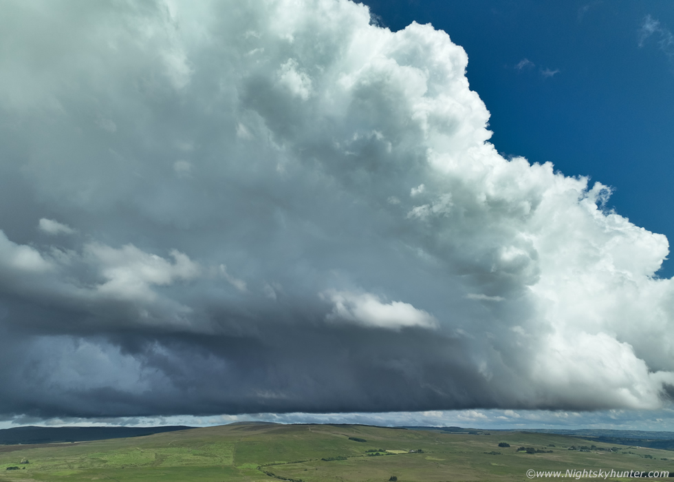
The updraught was completely tilted over in the shear aloft, in fact, the shear was actually much stronger over the E section of N. Ireland peeking during the mid afternoon which was now, at this time 0-6km shear was between 25 and 30 knots. I was verbally saying ''WOW'' out loud as I watched this beautiful storm exploding upward as we watched.
 |
I began filming aerial video sequences, I recorded footage tilting the camera slowly upwards following the updraught vertically until I reached its top almost overhead, since the storm had moved further E I could just barely get it into the frame. I was actually amazed this didn't produce another funnel rite here.
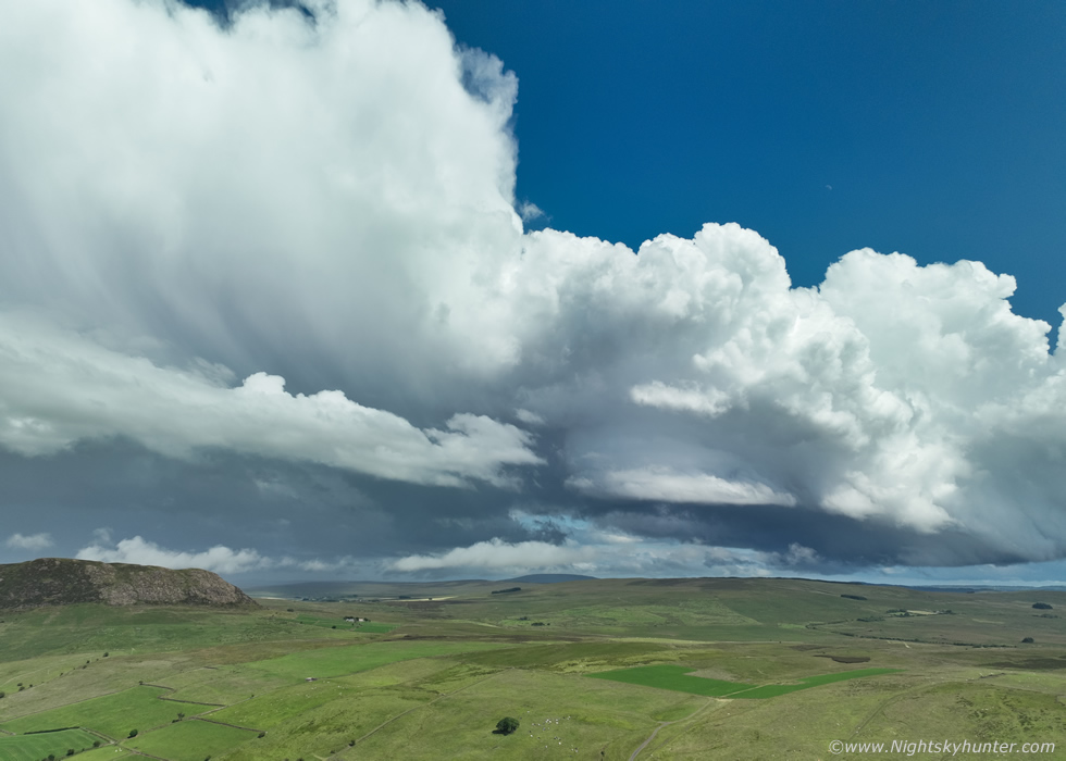 |
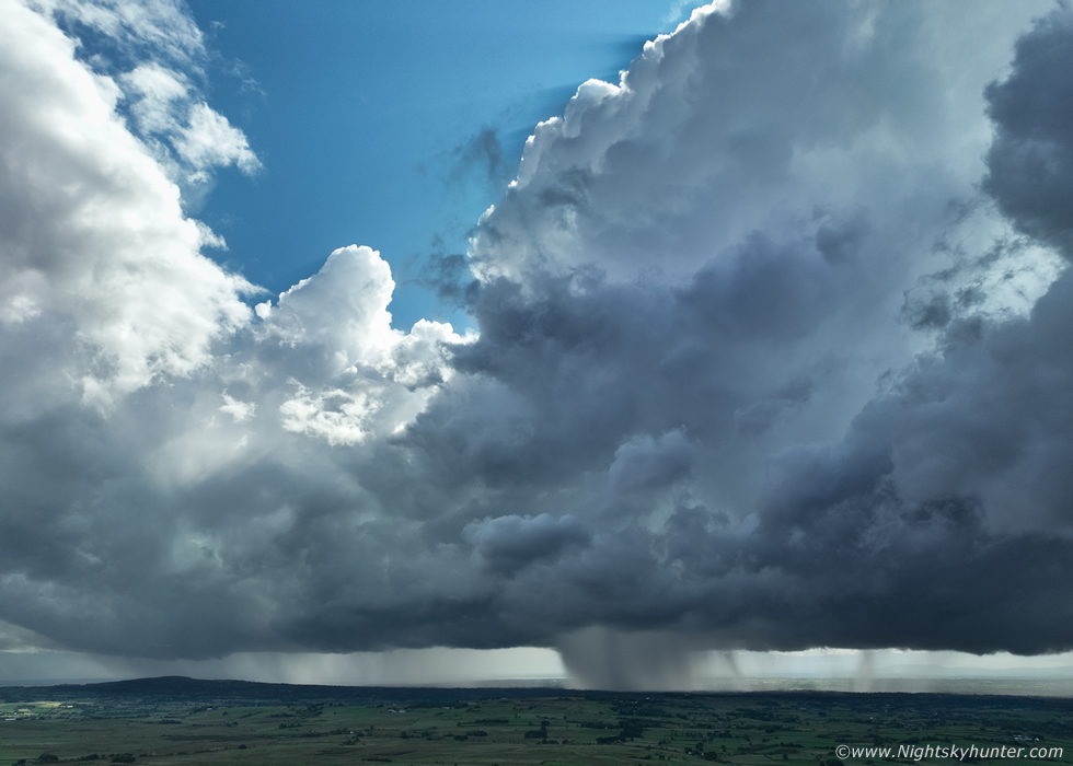
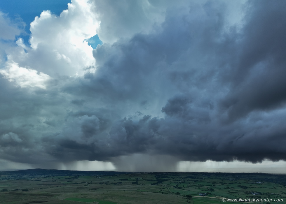
I thought this scene was gorgeous, part of Slemish in the foreground with the storm and stunning large updraughts on this growing multicell. Nigel showed me the radar, it had red and white cores and was producing plenty of lightning over the Glens Of Anrim. I got a nice video sequence here flying sideways over the landscape with this beautiful convection.
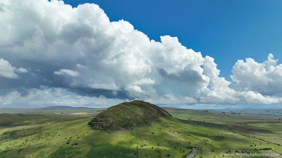 |
Slemish in full view with weakening multicell convection way off in the distance, you can certainly see why Slemish is a volcanic plug from this perspective. I really want to climb up there some day and watch for storms from that wonderful vantage point. That was a great afternoon, a funnel cloud, storm and beautiful updraught structures, I was honestly happy enough as this stage and considered the day a complete success, however it was still early days and we had another four or five hours of CAPE remaining so we rested, ate a few snacks, then checked radar for an update.
 |
The radar revealed numerous thunderstorms over the W of the country which was quite surprising as those areas were not even inside the low risk box today. Then more storms formed over the Sperrins, it was tempting to leave our location and chase after them but we had to be smart about it, after all, E was best, we decided to let him come our way and as they moved into the better CAPE and convergence the activity could intensify. It was now evening time and by this stage there was a scattering of visitors on Slemish, explorers, hikers and even a youtuber who was filming a vlog of the area. A nice family with Children arrived and they very quickly took a big interest in our cameras and drones wondering what we were up to.
We explained we were shooting storms and that we had one here earlier but more where forming out W and moving in, the Husband from the family seemed really interested and they decided to hang around to watch the skies. Then directly W a big cell formed, it had just departed the Sperrins and was slowly moving in our direction, even though it was many miles away we were struck by how crisp the convection was, radar already showed regular sferics from it so it looked like our next storm of the day was inbound. We pointed out the cell to the Husband who admitted he never would have known that was a storm and what to look for, we explained about the base and updraughts and the visual clues of how to spot distant storms, they were just as interested as we were. Above is a DSLR image of the approaching storm with towers, base, and new updraughts forming to the left, I began shooting another time lapse.
 |
Then the storm got closer, we could already hear distant thunder rumbling which already got the attention of others in the car park who began filming the storm on their phones, the vlogger was 100% focused on the storm now, I would love to see his channel to view this content. My DSLR was shooting a time lapse for a long time now, the entire evolution of this storm was being captured and I sensed a fantastic lapse on the cards, so I left my camera to it and got the drone back in the air. The clouds were getting very dark, there wasn't a great deal of precipitation at this point but the thunder suggested that the lightning was mostly happening within the towers.
 |
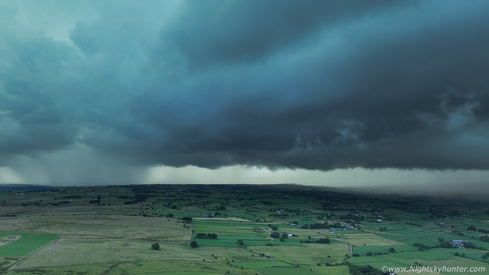
Now much closer, very loud thunder which was getting more frequent with no visible lightning yet, all in-cloud, this was one of the DSLR images which captures the naked eye view quite well. This thunderstorm was mean and getting very black, it was also back-lit by the sun from behind and above which made the clouds almost like night, the contrast between the storm and sunlit foreground was vast, it was also very difficult to shoot due to the high dynamic range. I found it difficult to do justice to the scene with the DSLR so I let it continue its time lapse and got the drone back up for another look, I'm glad I did.
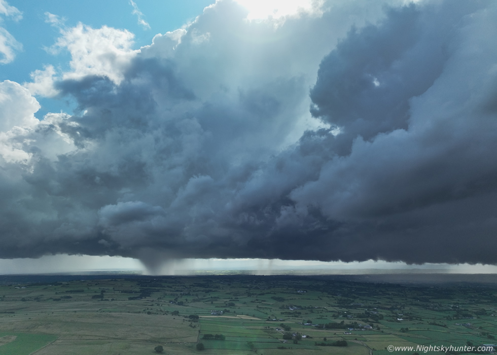 |
Drone hovering 100m high showing the same area, a new intense area of precip was breaking out to the W/SW of what was already an obvious multicell line. At this stage the sun was still peaking over the top of the storm making exposure extremely difficult, the sun was often in the frame sending flares and beams onto the sensor, I waited until the advancing storm eclipsed the sun then life would be easier.
 |
The sun vanished behind a mountainous Cumulonimbus updraught and photography become more straight forward. Due to the very black appearance of the storm the auto exposure on the drone was either completely blowing out the scene or under exposing it depending on what way I touched the screen. I then selected manual (Pro) mode and chose F/5 for maximum depth of field and sharpness, then left the shutter and ISO on auto so the drone would select those for me, this was a much better move. The drone exposed the storm nicely to reveal details in the clouds without blowing out the clear sky above, but keep in mind that in reality this storm varied from deep charcoal grey to black.
 |
Now a stunning thunderstorm with regular thunder and we began seeing horizontal lightning inside the cloud base, everyone in the car park was now fixated on the storm. This was a lot closer than it looked, full wide angle on the Mavic 3, I couldn't even fit in the tallest updraught plumes without removing the foreground completely, this was a big storm.
 |
Unknown to us at the time parts of Ballymoney and the surrounding countryside where getting impacted by torrential rainfall and intense hail storms. In fact, so much hail fell it turned gardens white like snow and some people who were unfamiliar with Summer time convective weather actually did mistakenly report snow falling in June. There were also strange unconfirmed reports on social media in the same areas of 'mini tornadoes', I'm not quite sure what that meant but I suspect witnesses were seeing overhead rotation due to the convergence zone.
 |
This was such a beautiful and majestic sight, we were all riveted to the storm with all our gear pointing W, Nigel had his lightning trigger in action, the shutter was clicking but he was just waiting for that magical moment when a c-g struck. Colleen had her drone in the air and was shooting a vlog, and I had my drone in the air while shooting a DSLR time lapse. I looked behind me and the family were still there with eyes locked on the sky, the Father said he had never seen a sky like it before, the Children were inside the car beginning to get scared of the thunder. Further back the vlogger from another country was still filming the storm with his phone mounted on an expensive looking gimbal. The storm was certainly getting a lot of attention, and rightly so. For a few gorgeous minutes an array of sun beams fanned across the deep blue sky overhead as sunlight interacted with the billowing updraughts. We got to soak-in these mighty thunderheads while still being dry and warm, this is why I absolutely love Summer.
 |
That's a nasty core, I managed a couple of quick video clips tilting the gimbal up to take in the updraughts then back down to the base but the storm was too big and close to capture in the wide angle field. This moment brought me back to the epic thunderstorm updraughts we witnessed on June 19th, on that evening we where W of the action so the storms were fully illuminated by the sun, this evening we where E of the storm so the cells were back-lit and dark. I was thinking what this must have looked like from the W in the sunshine, the storm must have been gorgeous and eye catching, yet I never saw a single image of this storm anywhere online. This was the impressive section of the multicell line, but it extended far beyond the frame to the right where a broad precip core was producing a lot of thunder combined with this core.
 |
Ground view with 15mm on full frame DSLR, thunder was now loud and angry, it got shouts of excitement from us, a few random c-gs were now being spotted while many of the bolts were still intra-cloud.
 |
Back to the drone and a 'bright' version of this very black storm, the core to the right looked somewhat benign here, almost transparent, but this was a very active area with increasing lightning activity, that core was also sneaking up on us fast.
 |
The storm was practically on top of us now, the other watchers were taking cover, we all stayed out for a few last precious minutes then I landed the drone rapidly. Drops of rain began falling and the lightning risk was now very real, Roisin had to visit her Sister so Colleen gladly let Rhua and I take shelter in her car. From there we watched the heavy rain and sky illuminated with random bolts, many of which looked pink in colour.
Once the storm passed over to the E went back outside, Nigel was already set-up on a high rise facing E with the lightning trigger and managed to capture a big bolt rite over the visitor centre, then the storm was gone, the ground dried up and the thunder became fainter as the storm passed over the Glens Of Antrim area once again. Meanwhile Owain Rice in Co. Down was also experiencing big thunderstorms with impressive updraughts, he even managed to capture a rare 'crown flash', this is more rare than any other form of storm structure in this country, I would even go so far as to say that it was even more rare than capturing a sprite on camera which is a testament to how powerful the updraughts were this day.
What a fun chase day this had been and hot on the heels of the other six chase days previous to this, what an amazing season this has been. Not only had we experienced many storms and prolific lightning, but many of them were dramatic and photogenic too which ticked all the boxes. Vlog and drone footage of both thunderstorms at Slemish including the funnel cloud above. Even though this day was a total success I did have a technical issue which prevented me from having potentially a fantastic time lapse of this entire storm through much of its life cycle and all in one take with no breaks. When I got back home I downloaded the images onto my external hard drive, I had a total of 7000 43MP DSLR images to edit and render into a time lapse movie.
I rendered the rotation part, then the convection maturing into a storm, but when I viewed the completed lapses I couldn't believe my eyes. The footage was bouncing up and down rapidly for the entire video. It was as if someone was knocking into the tripod, yet that wasn't the case, or perhaps the ground was uneven, but that wasn't the case either, the bouncing had too much rhythm and precision, this was a technical issue. I sent a copy of the footage to Nigel and he suspected it was a loose tripod head. This seemed a good explanation, I met Nigel a few days later and he examined the tripod, at first it seemed secure but when he unscrewed the head he observed that the internal mechanism was loose and shaky, even badly designed. Nigel kindly tightened it for me and applied thread glue to secure it better for future use.
So I ended up deleting over 6000 images and had a time lapse which ended up in the bin thanks to a loose tripod head. So a word of advice to anyone interested in storm time lapse cinematography - make sure all the bolts and screws on your tripod are secure, including the leg connectors. Also just get yourself a decent solid heavy duty tripod, it will pay for itself in the long run and will save you much heart ache.
Despite this nuance I still had my drone footage and I kept a few DSLR images so I never came home empty handed, sometimes using multiple recording devices pays off, that way you will always have something to fall back on. That being said, what a great day out and another winner for the 2023 N. Ireland storm season. If nothing else happens for the rest of Summer then I would be more than content with the wonders of nature we had experienced, however the season wasn't over by a long shot, find out more on the next chase report. Thanks very much for reading.
Martin McKenna
